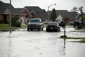
While spring brings the promise of warm weather, longer days, and bright greenery, springtime also comes as a prelude to hurricane season and heavy rains that could lead to flooding . Flash floods are the #1 weather-related killer in the U.S. since they can roll boulders, tear out trees, and destroy buildings and bridges. A flash flood is a rapid flooding of low-lying areas in less than six hours, which is caused by intense rainfall from a thunderstorm or several thunderstorms. Flash floods can also occur from the collapse of a man-made structure or ice dam. Flooding could happen anywhere, it is not limited to coastal areas or near a lake or creek, but some areas are more prone to serious flash flooding than others. The best way to learn if your neighborhood is one of these areas is to check out a flood map, the results of a study done by FEMA that analyzes statistical data for river flow, storm tides, hydrological/hydraulic analyses, and rainfall and topographic surveys. FEMA uses this data to create the flood hazard maps that outline your community’s different flood risk areas. These maps categorize locations into “high-risk,” “moderate-to-low risk” and “undetermined-risk” areas. Check out the link to see what your zip code is risked at.
